Research Highlights
ViSOAR for Agriculture
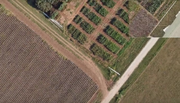 ViSOAR solutions by ViSUS provides fast reading and writing of 2D, 3D, or multidimensional grid data for platform agnostic collaborative analytics and visualization. Our latest product, ViSOAR Ag Explorer™, demonstrates the technical and commercial feasibility of real-time stitching of massive aerial image mosaics on commodity hardware. Drone captured images are stitched to form a map, allowing a crop consultant or farmer to immediately analyze images right after acquisition. ViSOAR Ag Explorer™ will remove the software bottleneck (time and labor) in processing large aerial surveys, enabling a cost-effective process to deliver actionable information to farmers. In turn, farmers and farm consultants can optimize the use of fertilizers and more finely control the amount of pesticides and herbicides necessary to increase crop yield. Furthermore, farmers mitigate costs and losses by being able to spot problem areas, minimize the spread of plant diseases, and identify issues such as standing water, irrigation malfunctions, and persistent automated machinery errors in planting or cultivation. The technology proposed by ViSUS is part of a broad initiative in agriculture addressing the need for a 70% increase food production by 2050 in response to the projected growth of the world's population.
Evolution of the Medical Classroom
Introducing ViSOAR
 As data acquisition advances, and data sizes increase, the need for tools to process and visualize the results in an effective and efficient manner is becoming increasingly important. The reliance on supercomputers for scientific visualization and analysis is already proving to be a hindrance for wide accessibility to researchers and scientists dealing with large data.
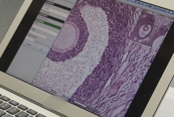
The Scientific Computing and Imaging (SCI) Institute and the Center for Extreme Data Management, Analysis, and Visualization (CEDMAV), in collaboration with ARUP Laboratories and the University of Utah, Department of Neurobiology and Anatomy, have developed ViSOAR--a multi platform visualization application for accessing and processing very large imaging data.